Sunday, October 29, 2017

ForĂȘt de Thy redux

Distance: 14.3 km.  Elevation low/high/total: 18/248/646 m.
Difficulty:5.8/10.  Scenic: 9.1/10
https://photos.app.goo.gl/xMntAeZXZZTnskXZ2

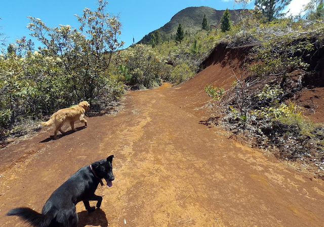
Two years after our first foray to this lovely spot, we return ... but htis time we had three dogs with us.  But it was as troublefree and fantastic as the first time.  Click pic for album, the geotrack is here

Paul is more cautious than I am.  So, between us that probably makes for a good danger/safe/fun balance on our hikes.  This particular one was our most "controversial" in the three years we've been hiking together.  On a lovely late October spring day, we headed off on this already-done hike, that is one of my favorites. The issue is that the destination is deep within, adjacent to actually, the tribal area of one of the more combative tribes agitating for immediate independence.  As a result, there is some fear of trouble should we encounter members of the local tribe, or even have our car targeted on the drive to the hike location.  Nothing happened to us, and the hike was fantastic.  Later, upon return, we heard that there had been trouble with the tribe that day and the road was closed.  But we missed that.  My guess is we don't do this one again but should tensions ease, I highly recommend this hike to one and all.  It's a bit lengthy but not difficult and the "swimming pool" is a fantastic payoff.


Sunday, August 20, 2017

Mine des Barbouilliers

Distance: 5.4 km (hike only).  Elevation low/high/total: 30/424/462 m.
Difficulty:3.5/10  Scenic: 5.8/10
https://goo.gl/photos/64G9mUVjiKpaY8i7A
Finally out and about on a new hike.  Pics are here and gpx is here

Well, it took 5 months, but finally Paul and I found a common time to join up for a hike.  Given that I just had (another) knee surgery, we choose a relatively easy hike.  Paul and I both have a new dog and they are amazingly similar looking.  Mine is the small one above, a female named Carlos (I didn't name her) and his is a male named Kenai (like the Alaska peninsula/river).  The trek was a slow climb up an old logging road to a long abandoned mining site.  the weather was so-so and even started to rain a little at the end.  But, with my recovering knee and Paul's problematic ankle, this was just the right level of difficulty and hopefully we'll be back to bigger hikes soon.

Sunday, March 12, 2017

Mont Tonta

Distance: 12.4 km (hike only).  Elevation low/high/total: 27/1122/1426 m.
Difficulty:9.2/10  Scenic: 8.8/10
A rather serious hike (by our standards).  Photos are here, hike gpx is here and full gpx including required biking and 75 minutes of wrong way hiking here.

My favorite kind of adventure involves a good dose of "mis" to make it more memorable.  Well, this outing had a bit of everything.  First, there was gaining access to the Mont Tonta hike itself. The trailhead  is along a heavily used mining road ... but the road is closed to the public ... or at least public cars.  Paul knew somebody who knew somebody and we learned we could throw our bikes over the barrier gate and bike the 5.6 km to the start of the hike. So, knowing it would be a hot and humid day, we got out of Noumea by 6 AM and had all gathered at the gate before 8 AM.  A new guy, Fabrice, joined me, Paul and sorta new guy Robert.  Fabrice is a bit out of our age class, but that turned out to be a good thing,  So, off we set .... on a 75 minute wrong way start to the hike, gaining 112 meters in the wrong direction.  By the time we figured out we were off track, we returned to the very start of the trailhead and officially started the hike at 9:30.  Not ideal.  The hike is hard (for us older guys).  There is no shade anywhere and it is relentlessly vertical, usually at a 30% incline,  I don't mind admitting that Paul and I considered not summiting and after a twisted ankle fall, I was ->  <- that close to calling it quits.  

But we decided to have lunch there, at about 650 meters (a bit more than half way up) and we sent the oldest and youngest guys on up ahead to summit and Paul and I dragged behind.  BUT WE MADE IT!  The odd thing was that the top 100 meters of the mountain was completely encased in dense fog/cloud and so what should have been a spectacular view instead was just a sea of white.  Didn't matter to me and Paul, we could now check Mont Tonta off our list.  Good fun with good people and I had a lovely river bath back at the base of the mountain.  There is nary a drop of water along the trail so if you ever do this hike, especially in the heat, take LOTS of water.  I went through 3+ liters on the way up and had to pace myself to conserve a bit for the return.  I also placed a geocache at the top (linked here) in an old maintenance or sleeping hut.  Up until 1970, radio equipment for the Tontouta airport was stationed here and there remains not only the former access road (very slippery and nowhere near driveable) but lots of old pieces of junk metal and such.


Sunday, January 29, 2017

Hiking (almost) to Camp Bloc

Distance: 18.2 km.  Elevation low/high/total: 18/154/561 m.
Difficulty:7.1/10  Scenic: 7.8/10
A relatively flat but semi-lengthy hike past the Marmites de diable.  Photo album is here and the gpx is here
A somewhat overcast Sunday morning made better by the fact that six other folks joined me for a day hike!  In addition to usual suspect Paul, who brought two grandkids of his - Djamila, age 16 and Donovan, age 12, we also had Robert, Tim and Andy.  In a light drizzle we commenced at the Dumbea river crossing by about 8:30 AM.  The river was high enough that we had to wade, shin deep, to begin the hike and then it was 3 hours of nice hiking.  The trek to the Marmites is mostly broad and flat, interrupted near the end by a path failure and a tricky crossing of the hill side.  That the rocks were wet and slippery and one wrong move would cause a twisted ankle or head first fall made the going a bit slow.  But we reached the crystal clear pools of the Marmites de diable in pretty good time and everyone had a grand swim.  We decided to give it a shot to make the next 5 km or so to get to Camp Bloc - no idea what's there, that's just how it's labeled on the map - but we got maybe halfway there from the Marmites and decided we'd gone far enough.  We were 9 km into the hike and the path was non-existent in many places so very tough, and treacherous clamoring over rocks.  We returned to the Marmites for more swimming and then, of course, 12 year old Donovan wanted to do the BIG JUMP into the biggest Marmite (pool).  A fun day and I think a good introduction to our day hiking.  Total distance hiked was just over 18 km and we were back by 4 in the afternoon.

Tuesday, January 10, 2017

Pic N'Ga

Distance: 4.5 km.  Elevation low/high/total: 36/262/243 m.
Difficulty:4.4/10  Scenic: 8.0/10
An easy 4.5 km round trip hike to the highest point on Isle of Pines.  Pics are here and the gpx is here
We came to the lovely Isle of Pines for  five days of rest and relaxation.  What we got was a lot of rain.  But, on our next to last day there was a break in the weather and so we took advantage to head out on one of the few hikes on the island.  Fantastic views the higher you go and from the top you see almost the entire island.  Found a geocache up top, took fun photos, had lunch and carried on.  One of the vacation highlights.