Friday, September 25, 2015

Chutes de la Madeleine - Sentier Botanique

Distance: 3.5 km.  Elevation low/high/total: 238/259/37 m.
Difficulty: 1.6/10.  Scenic: 8.9/10
A short but fun and scenic hike to a waterfall and a botanical stroll.  Click pic for album, gpx file is here.
It's New Caledonia Day weekend so we had a couple of extra days off.  With the choice of either an extra French lesson or a hike with the 'rents, Iris chose the hike.  We chose a relatively easy one and one that we attempted once before but got rained out.  While the weather threatened initially, it turned out to be beautiful. So we drove to the Netcha area and walked to the Madeleine waterfall (Chutes de la Madeleine) and strolled along the Botanical Path (Sentier Botanique).  Just lovely and peaceful.  Highly recommended as a hike with kids.  While it costs (400 XPF), that also gets you admission to Netcha which has a lovely swimming area a few km away, though we opted to skip that as it's not quite swimming weather yet so early in the spring as it is.

Saturday, August 29, 2015

Yate Dam - Chemin des Dalmates

Distance: 19.1 km.  Elevation low/high/total: 15/372/481 m.
Difficulty: 7.2/10.  Scenic: 6.1/10


One of our longer day hikes, quite varied: from brutal bushwhacking through razor grass to refreshing rain forest to a stroll along a paved road.  Pics linked above, gpx here or via track below


We wanted to change things up from the crushingly vertical nature of the previous hike (Tour des Sommets).  So after scouting about a bit, found this lengthy but seemingly relaxed hike and, after a 90 minute drive from Noumea, Paul and I got on the trail by 9 AM.  And finally back off the trail about 8.5 hours later.  This one is varied - the first 9 km are easy-peasy, as you stroll along an old access road of some kind, then along an actual real road.  But then you get into the fun.  5+ km of essentially no marked trail and the entire way is knee high razor grass and short trees with stiff branches.  I made the mistake of wearing shorts - thought of uploading a photo of my bloody shredded shins but we're keeping this family friendly.

The hike follows the riverbed of the now deceased Yate River which gave up the ghost so that artificial Lake Yate could have life ... curiously beginning about the time that both Paul and I began life .... let's just say 50+ years ago.  the section nearest the dam is fascinating - old riverbed littered with boulders that apparently get moved around every so often when they have vent the Lake due to excess water buildup.  The rest of the time it's mostly dry (save for the occasional rainstorm runoff from nearby mountains downstream of the dam).  We were in the area at high tide and a surprisingly lengthy section fills up with seawater.  At the end of the hike we were greeted with a near full moon so this was a day of a higher than usual high tide.  The final 5 km of the hike are actually really pleasant "normal" hiking through forest with soft earth underneath, birds chirping and no sharp rocks/slippery mud/unfordable rivers etc.  All in all, an OK hike and one I'd do again (though wearing long pants).

Saturday, August 15, 2015

Tour des Sommets

Distance: 7.2 km.  Elevation low/high/total: 455/1054/766 m.
Difficulty: 9.4/10.  Scenic: 9.6/10
Sweet mama, this one is a workout!  Two of the taller peaks near Noumea and tough vertical scrambles both up and down.  Click pic for photo album and the gpx file is here.

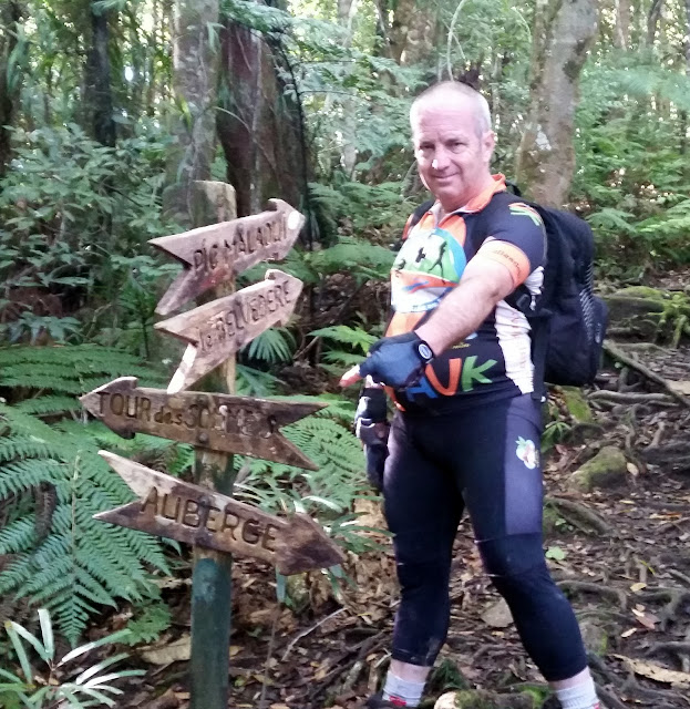
This is a fairly brutal hike (at least for a couple of old mountain goats like us)!  But eight hours of persistence paid off and we are able to put this one in the books (or blog, nowadays).  Most folks, I believe, hike this route in a counter-clockwise direction.  One parks at the Auberge de Koghi, strolls to the waterfall and then climbs the very (VERY!) steep path to the top of Mount Mone and continue.  We went the other direction.  I think it was the right move, but either way is very tough.

Our route up was to climb My Bouo first and that route is very technical - involving mostly sharp rock navigating - much of it under rainforest cover so the rocks are covered with moss and very slippery.  The possibility of twisting an ankle or taking fall and having a very nasty landing is very real.  It took us 3.5 hours to scale the first peak.  But aside from numerous cuts and bruises, we made it and FTF'ed a geocache there.  Next, you hike/scramble the saddle over to the taller peak Mt Mone.  The view from both peaks and at many lcations all along the "hike" are quite spectacular.  We had lunch at Mt. Mone and then faced the daunting task of getting down off that peak.  Measured by our geotrack the slope exceeds 45 degrees for the better part of a full kilometer and the surface is slippery red mud with sharp embedded rock.  We did most of it sliding on our butts (my hiking shorts got destroyed).  Fortunately, I brought gloves else my hands would be shredded.  

This is a worthy hike but not one I'm likely to repeat soon given how truly dangerous it is.  It's not really hiking, it's rock climbing.  The views are great .... but so are they at several of the other peaks nearby which are much less technically challenging.  But ... we made it and now look forward to our next challenge in  a couple of weeks.

Sunday, August 2, 2015

la forĂȘt Desmazures

Distance: 10.3 km.  Elevation low/high/total: 166/458/638 m.
Difficulty: 8.4/10.  Scenic: 6.1/10
A solo hike deep into a rain forest, generally with no visible path and only surveyor tape flags tied to branches as a guide.  Speaking of guides, a "real" French one gave me grief for hiking alone (made my day!). Click pic for Picture album.  GPX file here.

A beautiful, sunny, spring-like New Caledonia day practically yells for a good hike.  With my usual hiking pals all busy (or out of the country), I was left with the solo hike option, which is usually fine with me.  I scouted out an obscure hike not too far from Noumea and managed to identify one using a combination of OpenStreetMap and another local hiking blog.  The drive was only about 45 minutes out of town, but rather surprisingly I found nearly a half dozen vehicles parked at the trail head. a real novelty in my hiking experience here.

This is a difficult hike that is given less than a 9.0 only because of its relative brevity (4 hours, 10 km).  But the trail is essentially unmarked (save for surveyor tape) in many areas and the terrain is quite treacherous and dense in several areas. I made several wrong forays that probably earned me an extra km and half hour of hiking.  As much of the hike is rain forest, it was naturally raining most of the time despite the glorious sunshine that I could occasionally see in the distance over the ocean.

The main highlight of the hike are two pretty rivers that one crosses in the midst of the forest.  The first is about 5 km in and I had lunch there and cooled my feet.  I'd seen no one to that point; but at the second river (~ 7.7 km point) there was a crowd of about 15 people having lunch and soaking in river pools.  Turned out to be the group whose cars were parked at the trailhead.  It was a bit challenging to see where the path continued so I asked someone and they pointed me to their guide, a cranky old French guy.  I got within 5 meters of the guy and he just lit into me about how irresponsible and stupid I was to be hiking in this area on my own, yadda, yadda, yadda.  I smiled, thanked him (which only seemed to further infuriate him) and asked him which way the trail continued.  He would not tell me nor even look at my GPS, but a kinder English-speaking guy in the group said that he was pretty sure it continued across the river a bit further along.  Which it did.  Ah, the French being French; definitely added a bit of pep to my step the remainder of the hike.

There are several branch trails off the path I took so I think I'll be back to explore those (likely without a pricey, judgmental French guide).  Placed a geocache (linked here), got back to my vehicle without incident and returned in time to enjoy an ice cream treat with the family back in sunny Noumea.

Wednesday, July 8, 2015

Col du Ga Wivael/Roches de Linderalique

Distance: 9.3 km.  Elevation low/high/total: 12/283/628 m.
Difficulty: 7.7/10.  Scenic: 9.3/10
A "real" hike and one that could have been spectacular (had it been sunny).  Click the "Brooding Hen" (Poule Couveuse en francais) for pics; geotrack here.
There are two hikes in this region and, as they join at one point, I did both of them thus making two 7 km hikes into a single 10 kmm hike with a good amount of elevation change.  The views from the two peaks are spectacular, though less impressive against a cloudy sky.  These hikes are above the town of Hienghene and the rock formations are known as the Sphynx and the Brooding Hen.  The black limestone Roches de Linderalique are also fabulous - and I camped one evening near the base of the limestone rocks.  Great hike.

Monday, July 6, 2015

Sentier de Marais Sainat

Distance: 3.07 km.  Elevation low/high/total: 11/46/82 m.
Difficulty: 3.0/10.  Scenic: 6.5/10 (it was foggy)
A simple stroll, it's significance is that it's located at the far northern extreme of "Grande Terre", the main island of New Caledonia - a spot not often visited by tourists.  Pics by clicking above, geotrack here.
The first of just two hikes I could do on my walkabout (the caves didn't really count as a hike) but this was nice given its location.  I loved the signs explaining how the Kanaks view nature and the resident animals.  Had a nice picnic during a drizzle break.  Would love to return when the sky was blue.  And also to tear down the stupid cell phone tower that's erected at essentially the northernmost point of Grand Terre.

Grottes de Koumac (Caves of Koumac)

Distance: ~ 700 m.  Elevation low/high/total: 15/15/0 m.
Difficulty: 8.5/10 (scary/bats).  Scenic: 1.0/10 (pitch black)
Not so much a hike a as a dare, I explored these caves despite the dire warning not to do so by myself.  Small set of pictures can be seen by clicking above, location of cave area here.
This is a bit of fun.  If you like dark places, filled with bats, and the potential for being "gassed".  Took me three tries to find the right way in and then I got lost (thanks, random punks that paint "wrong way out" arrows all over the place) briefly before finally finding an exit about 80m from where I entered.  Can't wait to show this place to Ildiko.